Surveying and Mapping

Utility Surveying
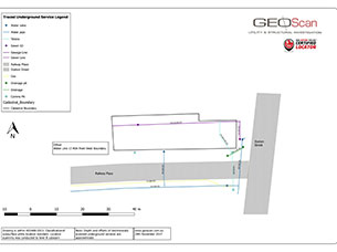
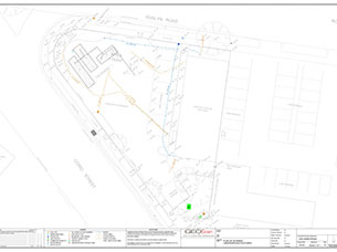
At Geoscan, we don’t just locate underground services — we survey all findings to provide accurate, actionable data. Our trained locators record essential metadata, including asset ownership, pipe material and size, and invert levels, ensuring every measurement is correctly captured. They also document observations on-site, linking photos to plans and reports for issues such as broken pits, blocked conduits, or buried cables. With extensive experience untangling complex networks of utilities, we draft detailed plans showing precise locations and connections. To enhance accuracy and visual reference, we incorporate drone or high-resolution aerial imagery. We also provide basic utility setout, as-built surveys of new services, and 3D scanning of chambers or large manholes, delivering comprehensive subsurface mapping and documentation for our clients.
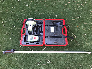
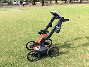
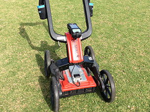
GPR Mapping
At Geoscan, we specialise in advanced GPR investigations to accurately detect and map subsurface features. Our services include:
-
Locating underground tanks
-
Conducting tree root investigations
-
Profiling road and surface layers for thickness and depth calculations
-
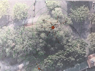
Producing heatmaps to visualise GPR findings and raw data
-
Providing on-site markings for immediate reference
-
Fully surveying and mapping findings for CAD, GIS, or reporting purposes
These capabilities give clients a clear, actionable view of subsurface conditions, supporting smarter planning, safer construction, and informed decision-making.


Drainage Investigation Surveys
At Geoscan, we regularly lift and inspect manholes, collecting accurate depths to invert to ensure complete and reliable drainage assessments. Our drainage investigation surveys support the design, maintenance, and management of drainage systems, providing clients with precise data for planning or improvements.
Our services include:
-
Pit and Pipe Inspections: Detailed inspections capturing key data such as invert levels, pipe sizes, materials, and Australian Height Datum (AHD) information.
-
Asset Owner Verification: Collecting and confirming asset ownership details for proper management and future development.
-
Photographic Documentation: High-quality photos to record irregularities, damage, or potential issues within the drainage network.
-
3D Scanning: Advanced 3D scanning of manholes and chambers to identify problems such as broken pipes, cracked walls, and vertical misalignments.
-
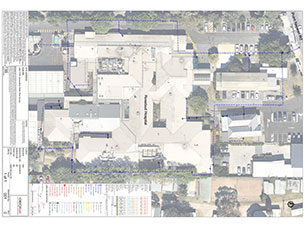
Orthomosaic Imagery: High-precision drone imagery integrated into CAD for accurate and detailed survey plan drafting for a visual reference as to where the pit and pipes are.
-
CCTV and Video Management: Coordinating CCTV and video inspections to provide complete reporting on drainage conditions.
With Geoscan’s Drainage Investigation Surveys, you receive comprehensive, survey-grade data and actionable insights to support safer, more efficient drainage management and infrastructure planning.
Reports are delivered daily and drawings are delivered within 5 days after field work
Photo Gallery