Projects & Case Studies — Geelong & Victoria

From heritage drain investigations in the Geelong CBD to subsurface mapping at major stadium upgrades, agricultural facilities, schools, and churches — Geoscan has delivered accurate underground detection and utility survey results across a wide range of industries and environments. Below is a selection of completed projects that demonstrate our capability, approach, and the value we bring to every engagement.

Geotechnical Basalt Layer Investigation

Ground Penetrating Radar | Geotechnical Assessment | Geological Mapping

A geotechnical assessment firm engaged Geoscan to determine the precise depth and profile of a basalt rock layer escarpment at a Victoria site. The escarpment was critical to the client’s foundation design, and drilling locations needed to be accurately planned to avoid unnecessary costs and delays. Using ground penetrating radar, Geoscan produced detailed radar images of the basalt layer at depth, generating a subsurface profile that allowed the geotechnical team to confidently plan their investigation programme. The GPR methodology was non-invasive, faster, and more cost-effective than conventional test pitting across the escarpment footprint.

Outcome: Geoscan delivered a detailed report including radar imaging photographs and subsurface profile data, giving the client a clear picture of the basalt layer location and depth to inform their foundation investigation strategy.
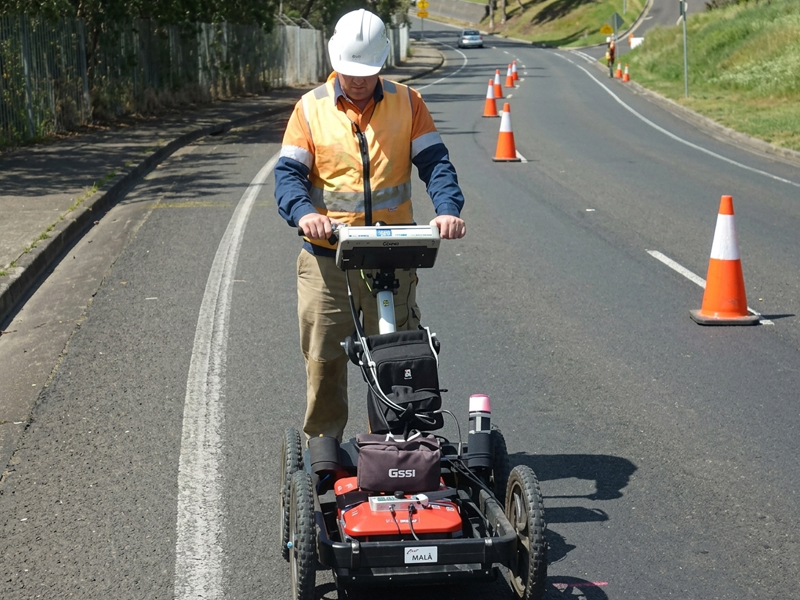
GPR radar image showing basalt rock layer escarpment depth profile — Geoscan ground penetrating radar investigation Victoria.

Buried Irrigation Valve Detection — Local Government Authority

Ground Penetrating Radar | Local Government | Infrastructure Recovery
A local government authority contacted Geoscan after an irrigation control system had been out of service for approximately 12 years. The master control unit — housed in a buried valve box — could not be located using site records, which were incomplete and out of date. The area had since been landscaped over, making visual detection impossible. Using ground penetrating radar, Geoscan systematically scanned the search area and identified the precise location of the buried valve box beneath the surface. Ground markings were applied for the client’s works crew, who then excavated directly to the valve box on the first attempt, avoiding unnecessary digging and surface damage. Once exposed, the irrigation system was reactivated and returned to service.

Outcome: The valve box was located on first excavation, eliminating guesswork and preventing damage to surrounding landscaping. The client’s irrigation system was reactivated after more than a decade out of service.
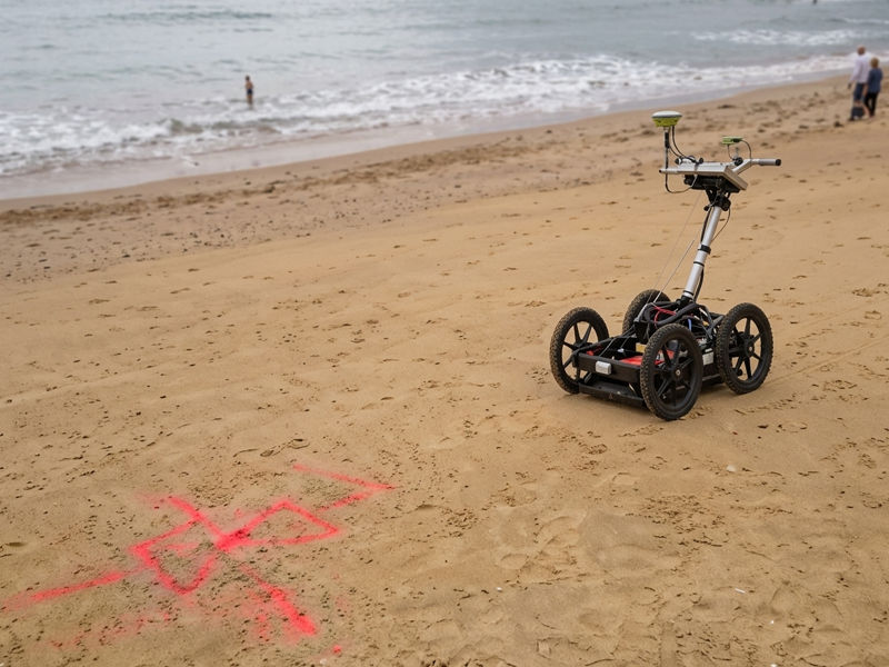
GPR equipment and ground markings showing location of buried irrigation valve box — Geoscan GPR scanning for local government client.

Underground Cable Fault Detection — TAFE Campus

Cable Fault Detection | Electrical Infrastructure | Education Sector
Geoscan was engaged to locate a fault in a mains electrical cable supplying a TAFE college campus. Testing had confirmed that one phase of the supply had failed, cutting power to a key building that housed critical computer and data systems for administration and campus operations. With students and staff depending on these systems, restoring power quickly was essential — but excavating the entire cable run without knowing the fault location would have caused significant disruption and cost. Geoscan deployed advanced cable fault detection equipment to narrow the fault to a precise location within the cable run, allowing the electrical contractor to target their excavation accurately and minimise the footprint of the repair works.

Outcome: The fault was pinpointed precisely, enabling targeted excavation rather than a full cable trench. Power was restored to the affected building with minimal disruption to campus operations.
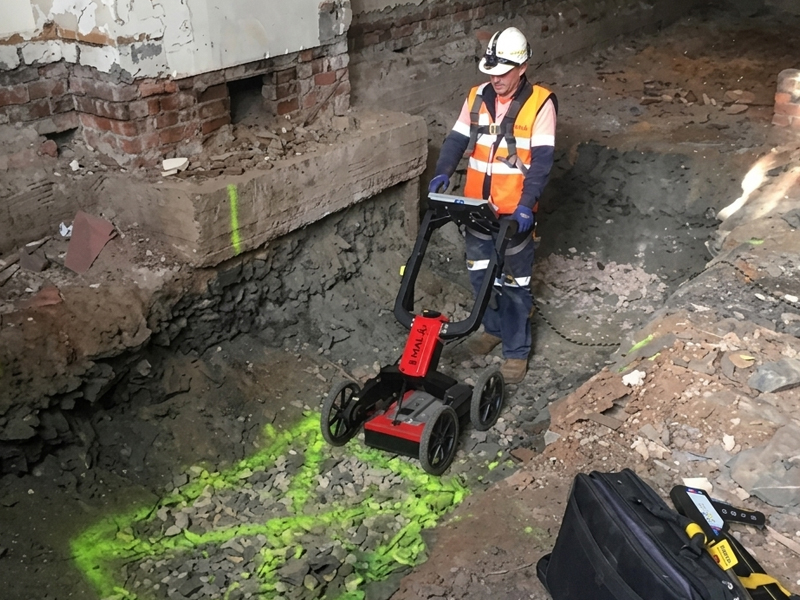
Underground cable fault detection equipment deployed by Geoscan for TAFE campus electrical fault location

Al Taqwa College — Subsurface Utility Survey & Mapping

Utility Locating | GPR Scanning | Utility Survey | Education Sector | Architectural Planning
Geoscan was engaged by Al Taqwa College to survey and map the underground utilities across key areas of the school, with a particular focus on the precinct surrounding the Mosque building. The site presented a significant challenge: years of incremental development had left a complex network of stormwater and sewer infrastructure hidden beneath old concrete slabs and superseded services. Incomplete records meant architects and engineers could not confidently plan upcoming building works without risking service strikes or delays. Geoscan deployed a combination of ground penetrating radar, electromagnetic service locating, and physical rodding to systematically trace and confirm the full network of subsurface utilities across the site. Each service was accurately identified, its depth and material recorded, and all findings marked and surveyed. The resulting utility survey plan gave the design team a clear, reliable map of the existing subsurface infrastructure for the first time.

Outcome: The survey resolved longstanding uncertainty about the site’s underground infrastructure. Architects and engineers received a comprehensive utility plan that allowed building design to proceed with confidence. The project was completed on time and within budget.
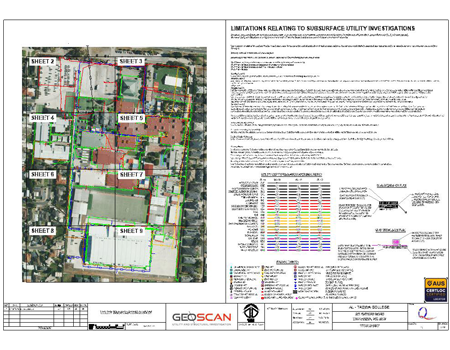
Geoscan utility survey and GPR scanning at Al Taqwa College — subsurface infrastructure mapping for architectural planning.

Gheringhap Street Heritage Drain Investigation — AusNet & Downer

Drainage Investigation | GPR Scanning | AS 5488:2022 | Civil Infrastructure | Heritage Assets
Geoscan was engaged by AusNet and Downer to carry out a heritage drain inspection along Gheringhap Street in Geelong, from Johnstone Park to Corio Bay, in support of a major proposed precinct development. The primary asset of interest was a 1.7 metre brick oval drain — a significant piece of heritage infrastructure running beneath the street — and the objective was to identify all feeder lines entering the drain to assess flow capacity and plan for the careful relocation of intersecting services. Working methodically along the drain corridor, Geoscan used GPR and physical inspection techniques to map the full extent of the drainage network. All feeder line entry points were identified, the drain’s condition was assessed, and all findings were marked on the ground in accordance with AS 5488:2022, ensuring that the survey data could be accurately captured by the project’s surveying team for inclusion in the development’s engineering drawings.

Outcome: A comprehensive drainage network plan was delivered to AusNet and Downer, providing the data required to safely and effectively plan service relocations and integrate the new buildings with the existing heritage drainage infrastructure along Gheringhap Street.

Geoscan drainage investigation and GPR scanning along Gheringhap Street Geelong — heritage drain mapping for AusNet and Downer.

GMHBA Stadium — Heritage Drain GPR Investigation

Ground Penetrating Radar | Drainage Investigation | Heritage Asset Protection | Stadium Infrastructure
Geoscan was commissioned to investigate drainage infrastructure at GMHBA Stadium in Geelong following concerns raised during the planning of upcoming stadium upgrade works. The critical asset was a heritage-listed brick-arched drain running through the Geelong CBD, discharging into the Barwon River — a piece of infrastructure that could not be disturbed or damaged during the planned construction activities. The primary task was to determine the exact depth to the top of the drain arch so that engineers could calculate the safe working envelope above it. Using ground penetrating radar, Geoscan scanned the relevant areas to obtain precise depth readings to the crown of the drain, supplementing the scan data with detailed reporting that could be used directly by the structural engineering and project management teams.

Outcome: The investigation provided the depth and profile data required to protect the heritage drain throughout the stadium upgrade works, giving engineers a confident basis for their construction planning and ensuring the heritage asset was safeguarded.
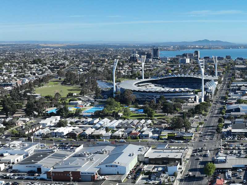
eoscan GPR investigation at GMHBA Stadium Geelong — heritage drain depth detection for stadium infrastructure upgrade planning.

Bulla Dairy — Trade Waste, Drainage & Sewer Investigation, Colac

Drainage Investigation | CCTV Inspection | Utility Survey | Industrial | Environmental Compliance
Geoscan was engaged by Bulla Dairy to locate, inspect, and survey the trade waste, drainage, and sewerage systems at their Colac ice cream manufacturing facility. Over many years of incremental development, numerous incorrectly installed pipes and pit connections had resulted in trade waste being unintentionally discharged into both the stormwater and sewer networks — a serious environmental compliance issue that needed to be fully understood and rectified. Working carefully within the operational constraints of a live manufacturing environment, Geoscan systematically rodded and camera-inspected the entire drainage network, recording invert depths, pipe sizes, materials, and pit cover levels throughout. The team navigated tight access areas around live production equipment and ensured all work was completed with minimal disruption to the factory’s operations. Every runoff path was traced and documented, including connections that had previously been unknown or incorrectly assumed.

Outcome: Bulla Dairy received a comprehensive drainage network survey that gave them complete clarity on how trade waste was moving through their facility. The survey data provided the foundation for a full drainage redesign that resolved the cross-contamination between stormwater and sewer systems, ensuring the facility met its environmental obligations.
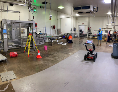
Geoscan drainage investigation and CCTV inspection at Bulla Dairy Colac — trade waste and sewer network survey for environmental compliance.

Boomaroo Nurseries, Lara — Utility Locating & Survey Plan

Utility Locating | Utility Survey | AS 5488:2022 | Agricultural / Commercial | Contractor Reference
Boomaroo Nurseries is one of Australia’s largest commercial nursery operations, and their Lara facility is a working site with significant underground infrastructure servicing the extensive greenhouse and growing areas. Geoscan was engaged to carry out a comprehensive utility locating and survey programme across the nursery, identifying and mapping the full extent of underground services including water mains, irrigation lines, electrical and telecommunications conduits, and drainage infrastructure. The resulting utility survey plan was designed not just as a record for the client’s own asset management — but as a working document for all contractors, maintenance teams, and tradespeople operating on site. Clear, legible plans showing the position and nature of all located services mean that anyone undertaking works at the nursery can immediately identify what’s underground in their work area before a shovel goes in the ground, without needing to call in a locator for every minor task.

Outcome: Boomaroo Nurseries received a comprehensive utility survey plan compliant with AS 5488:2022, giving the facility a reliable, up-to-date record of all underground services that contractors and maintenance teams can use with confidence for years to come.
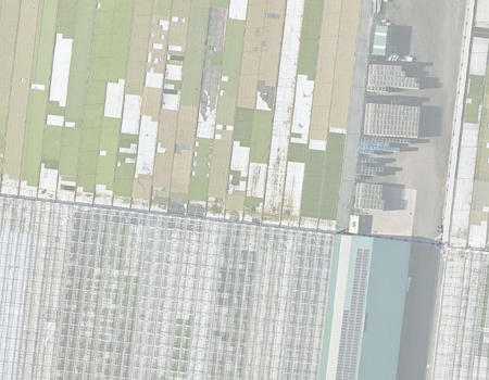
Geoscan utility locating and survey plan at Boomaroo Nurseries Lara — underground service mapping for contractor reference.

St Mary's Church — Utility Survey, Aerial Imagery & Long-Term Contractor Plans

Utility Locating | Utility Survey | Drone Orthomosaic Imagery | Heritage | Contractor Reference Plans

Historic church sites present a unique challenge for utility management: services installed and modified over many decades, often without comprehensive records, on sites where careful groundwork is essential to avoid damage to both the building fabric and the surrounding grounds. Geoscan was engaged to carry out a full utility locating and survey programme at St Mary’s Church, producing a plan that would serve not just the current maintenance team — but all contractors working on the site for generations to come. Following the underground locate and survey, Geoscan integrated high-resolution drone orthomosaic aerial imagery into the survey plan, providing a detailed photographic base layer that shows the precise spatial relationship between the located services and every fixed feature of the site. To maximise usability across the full range of contractors who might reference the plan, Geoscan drafted the final survey in two formats: a full-detail A1 plan for engineers and principal contractors, and a simplified A3 printable handout version for tradespeople working on site. Critically, all located service positions were dimensioned from fixed reference features — the church facade, permanent fencelines, and boundary features — so that the plans remain accurate and usable even as the site evolves over time, without needing specialist survey equipment to re-establish positions in the field.

Outcome: St Mary’s Church now holds a comprehensive, future-proofed utility plan that gives every contractor — from an emergency plumber to a heritage architect — an immediate, reliable picture of what lies underground and exactly where. The combination of survey data, aerial imagery, and fixed-feature dimensioning means the plans will remain useful and accurate for many years without needing to be re-done.
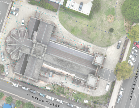
eoscan utility survey and drone orthomosaic aerial imagery at St Mary's Church

Geelong Grammar School — Ongoing Utility Locating, CCTV & Surveying

Utility Locating | CCTV Inspection | Utility Survey | Education Sector | Asset Management
Large educational campuses like Geelong Grammar School have extensive underground infrastructure built up over many decades — a mixture of original services, upgrades, and additions that can make routine maintenance and new works genuinely complex. Geoscan has been engaged on an ongoing basis by Geelong Grammar School to provide utility locating, CCTV drainage inspection, and surveying services as required across the campus. The value of this ongoing relationship is consistency and cumulative knowledge: with each engagement, Geoscan’s understanding of the campus’s underground infrastructure deepens, and the school’s maintenance and estates team gain a reliable, go-to partner they can call on whenever works are planned. Before any trench, core hole, or ground disturbance is made, the school’s team can confirm what’s underground, where it runs, and where it’s safe to work. When maintenance issues arise — blocked drains, collapsed conduits, failing services — CCTV inspection allows the nature and location of the problem to be understood before any excavation decision is made, saving both time and money.

Outcome: Geelong Grammar School’s maintenance team has a trusted, ongoing survey and locating partner that helps them manage the complexity of the campus’s underground infrastructure safely, efficiently, and cost-effectively — knowing where to dig, and where not to.
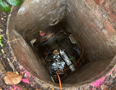
Geoscan utility locating and CCTV drain inspection at Geelong Grammar School campus — ongoing underground asset management for education sector client.

JK Grant Reserve, Altona — GPR Buried Rock Profile & Irrigation Line Investigation

Ground Penetrating Radar | Subsurface Investigation | Oval Redevelopment | Local Government
Prior to the planned redevelopment of JK Grant Reserve oval in Altona, the project team needed to understand what lay beneath the playing surface — specifically, whether any buried rock formations or subsurface obstructions were present that would affect excavation costs and methodology. Unknown rock profiles are one of the highest-risk unknowns on any civil earthworks project: if rock is encountered after pricing, the cost impact can be substantial. Geoscan was engaged to carry out a comprehensive GPR investigation of the oval, scanning for both the irrigation infrastructure running beneath the surface and any subsurface rock formations. The investigation identified the location and depth of the existing irrigation lines — enabling the project team to plan their removal or relocation — and produced a profile of subsurface rock formations across the oval footprint, giving the project team a clear picture of what would be encountered during earthworks before any pricing was finalised.

Outcome: The JK Grant Reserve project team received a detailed subsurface investigation report that quantified the extent and depth of buried rock across the oval, allowing accurate earthwork removal costs to be factored into the project budget before construction commenced. The client avoided the financial risk of discovering rock unexpectedly mid-project.
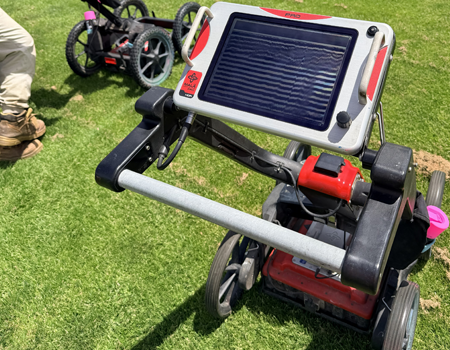
eoscan GPR investigation at JK Grant Reserve oval Altona — subsurface rock profile and irrigation line detection prior to oval redevelopment.

Ukrainian Church — GPR Tree Root Investigation

Ground Penetrating Radar | Tree Root Mapping | Heritage Structure | Arboricultural Investigation
An established tree adjacent to a Ukrainian church had been growing in close proximity to the building’s facade for many years, and concerns had been raised about whether the tree’s root system was encroaching on the church foundations and external walls. Tree root damage to old masonry structures can be progressive and severe — roots growing into mortar joints and beneath foundations can cause cracking, displacement, and long-term structural compromise. Understanding the extent, depth, and direction of the root system was essential before any decision could be made about tree management or remediation of the structure. Geoscan deployed ground penetrating radar to map the root system beneath and around the church, scanning systematically to detect root mass distribution, depth, and the proximity of major roots to the building’s foundation line. The GPR data provided a three-dimensional picture of the root system that neither visual inspection nor invasive investigation could have delivered as safely or non-destructively.

Outcome: The church committee received a detailed root mapping report showing the extent, depth, and proximity of the root system to the church facade and foundations. This information gave their arborist and structural engineer the data needed to make informed, evidence-based decisions about tree management and any foundation protection works required — without needing to excavate.
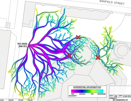
Geoscan GPR tree root investigation adjacent to Ukrainian church facade

Industries We Support

Geoscan’s utility locating, GPR scanning, drainage investigation, and cable fault detection services support a broad range of industries across Geelong, Melbourne, and regional Victoria:
  • Civil construction and excavation contractors
  • Local government authorities and councils
  • Architects and design engineers
  • Geotechnical engineers
  • Universities, TAFEs, and schools
  • Hospitals and healthcare facilities
  • Surveyors
  • Petroleum and energy industry
  • Road authorities and transport agencies
  • Pipeline laying contractors
  • Plumbing and electrical contractors
  • Plumbing and electrical contractors
  • Arborists and tree surgeons
  • Department of Justice and government agencies

Got a Project? Let’s Talk.

Whether your project is straightforward or complex, Geoscan has the experience, accreditation, and equipment to deliver accurate results across Geelong, Melbourne, and Victoria. Get in touch today for a fast, no-obligation quote.