Ground Penetrating Radar Investigation in Geelong
Plan with confidence, uncover what lies beneath, and make informed decisions with Geoscan’s Ground Penetrating Radar (GPR) investigation services.
Whether you’re an engineering firm finalising plant designs, an archaeologist mapping subsurface features, or an environmental consultant assessing soil conditions, our GPR solutions deliver accurate, non-invasive subsurface data. Geoscan provides clear, actionable insights to support safer construction, smarter planning, and reliable reporting.

What is Ground Penetrating Radar (GPR)?
Ground Penetrating Radar (GPR) is a geophysical technique that allows you to see beneath the surface, detecting objects, voids, cracks, or changes in material without excavation. It is widely used to investigate rock, soil, ice, freshwater, pavements, and built structures.
At Geoscan, our GPR services provide accurate, non-invasive subsurface data, giving you clear insights to plan, design, and make informed decisions. Industries that benefit most include engineering, geology, environmental studies, and archaeology. Whether you’re finalising a plant layout, studying soil conditions, or mapping archaeological sites, Geoscan delivers reliable, actionable results to support safer construction, smarter planning, and comprehensive reporting.
How Geoscan leverages this technique?
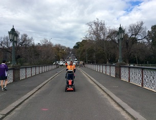
Geoscan is efficient to leverage this scientific technique to the fullest. We have the equipment that facilitates electronic depth readings. In order to take full advantage of Ground Penetrating Radar imaging technique, we have the latest equipment that:
Read more about how we do our work here in our FAQs.


Why choose Geoscan’s Ground Penetrating Radar services?
Our experience over the years and proven track record speak for themselves. Our services are trusted by the following industries and professionals:
Road Authorities
Civil Engineering
GPR Object, Profile and Heat Mapping
At Geoscan, our Ground Penetrating Radar (GPR) services go beyond simple detection. We provide detailed insights into the subsurface, helping clients identify objects, anomalies, and changes in material without excavation. Our services are ideal for engineering, construction, environmental studies, and archaeological projects.
Our capabilities include:
- Heatmapping of anomalies such as rocks, voids, or buried debris
-
Profiling road layers to assess depth, composition, and integrity
-
Oval depth mapping for underground pipes, conduits, and utilities
-
Accurate detection of buried pipes, cables, and other subsurface features
-
Delivery of survey-grade data suitable for CAD or GIS integration
With Geoscan’s subsurface mapping, you gain a complete picture of what lies beneath, enabling smarter planning, safer excavation, and informed decision-making.
While providing Ground Penetrating Radar services in Geelong and regional Victoria, Geoscan also leverages its unique device called the time triggering method. This method allows us to decipher ground disturbances taking place beneath the surface due to water leaks or any other subsurface instability


Wide Range of Scanning
Other areas in which Ground Penetrating Radar imaging can be immensely helpful, are:
Location of underground voids and ground disturbance
How it works?
Call Geoscan now and learn more about Ground Penetrating Radar investigation in Geelong and regional Victoria.
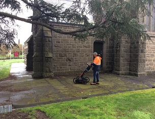
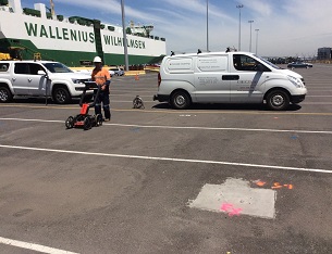
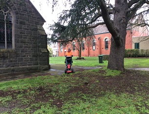
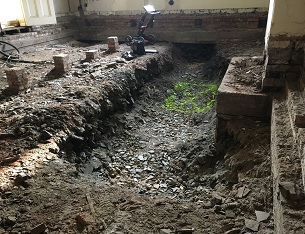
Photo Gallery